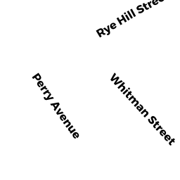
131 PERRY AV
Owner Information
WEBER CHARLES A & ANN MARIE
131 PERRY AV
HANSON, MA 02341


Property Details
131 PERRY AV is classified as a Single Family Residential (Conventional).
The primary structure on this property was built in 1900. There are 2,434ft2 of built area within this property. There is 2,434ft2 of residential/living space within this property. This property is listed as having 9 rooms.
131 PERRY AV is valued at $508,900. The land is valued at $157,800 and the structures are valued at $341,500. There is an additional valuation of $9,600 on this property.
The most recent deed for 131 PERRY AV is recorded at the local registrar in Book 48596, Page 20-21. 131 PERRY AV was last sold on Wednesday, June 28, 2017 for $400,000.
Assessment data from fiscal year 2022.
Flood Data
According to the FEMA National Flood Hazard Layer, this property does not appear to be in a flood zone. It may also be in an area not yet reviewed. Nonetheless, confirm this information prior to taking any action.
To view the flood hazards around this property, create a FEMA "Firmette" Map of the area around 131 PERRY AV.
Broadband Internet Providers
| Provider | Type | Bandwidth (mbps) | |
|---|---|---|---|
| T-Mobile | Fixed Wireless | 25 | 3 |
| Viasat Inc | Satellite | 100 | 3 |
| GCI Communication Corp. | Satellite | 0 | 0 |
| VSAT Systems, LLC. | Satellite | 2 | 1 |
| HughesNet | Satellite | 25 | 3 |
| Verizon New England Inc. | DSL | 5 | 0 |
| Comcast | Cable | 1000 | 35 |
Broadband service provider data from December 2020.
Adjacent Properties
- 0-REAR PERRY AV
Undevelopable Residential Land owned by WEBER CHARLES A & ANN MARIE - 141 PERRY AV
Single Family Residential owned by CORDERO LISETTE & - 42 LANCE LN
Single Family Residential owned by GILLIS MATTHEW & KRISTY - 0 HOLLY RIDGE DR
Undevelopable Residential Land owned by CAMERON EDWARD & JOANNE - 45 LANCE LN
Single Family Residential owned by YOUNGCLAUS EDWARD G - 113 PERRY AV
Single Family Residential owned by THOMPSON DAVID B & ANN M TR